|
<< Click to Display Table of Contents >> Changing the View Extents |
  
|
|
<< Click to Display Table of Contents >> Changing the View Extents |
|
The view extents can also be edited by selecting Edit > View Extents. This will display the View Extents form.
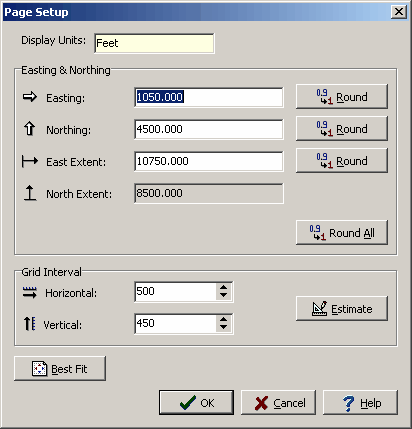
The following can be edited on this tab:
Display Units: These are the local units of the project. This field can not be edited.
Easting & Northing
Easting: This is the minimum horizontal extent of the view in local units. The Round button will round this number.
Northing: This is the minimum vertical extent of the view in local units. The Round button will round this number.
East Extent: This is the horizontal extent of the view in local units. The Round button will round this number.
North Extent: This is the vertical extent of the view in local units. This is calculated by the program so that the aspect ratio of the map is maintained.
Grid Interval
Horizontal: This is the horizontal grid interval for the view.
Vertical: This is the vertical grid interval for the view.
Estimate: Click this button to estimate the horizontal and vertical stepping.
Best Fit: Click this button to round all the extents and estimate the grid stepping.