|
<< Click to Display Table of Contents >> Creating a View |
  
|
|
<< Click to Display Table of Contents >> Creating a View |
|
To create a structure view either select File > New > Building/Structure View, click on the New button on the Main toolbar and select Building/Structure View, or click on the Structures category on the sidebar and then select Popup > New. After this the New Building/Structure View form will be displayed. This form has two tabs one for the Location Map and one for the Selection Extents. At the top of the form a unique name should be specified for the view.
Location Map Tab
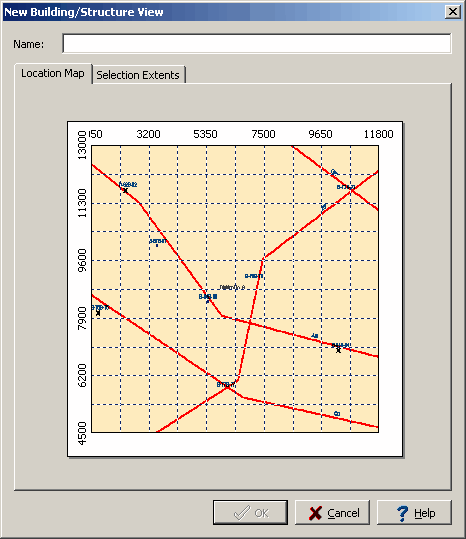
The Location Map tab displays the project map and can be used to set the areal extent of the view. To set the areal extent of the view, click the mouse one corner of the selected area of the map and move it diagonally to the opposite corner and then release the mouse button. The selected areal extents will then be shown on the Selection Extents tab.
Selection Extents Tab
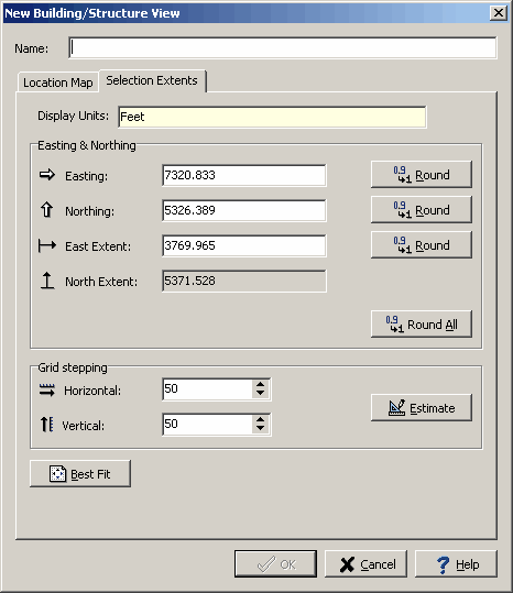
The following can be edited on this tab:
Display Units: These are the local units of the project. This field can not be edited.
Easting & Northing
Easting: This is the minimum horizontal extent of the view in local units. This field can also be set on the Location Map tab. The Round button will round this number.
Northing: This is the minimum vertical extent of the view in local units. This field can also be set on the Location Map tab. The Round button will round this number.
East Extent: This is the horizontal extent of the view in local units. This field can also be set on the Location Map tab. The Round button will round this number.
North Extent: This is the vertical extent of the view in local units. This is calculated by the program so that the aspect ratio of the map is maintained.
Grid Intervals
Horizontal: This is the horizontal grid interval for the view.
Vertical: This is the vertical grid interval for the view.
Estimate: Click this button to estimate the horizontal and vertical stepping.
Best Fit: Click this button to round all the extents and estimate the grid stepping.