|
<< Click to Display Table of Contents >> Adding a Dataset |
  
|
|
<< Click to Display Table of Contents >> Adding a Dataset |
|
To add a dataset to the contour map click on the Add Dataset button on the Data form. The Select Dataset form will be displayed, showing a list of datasets available.
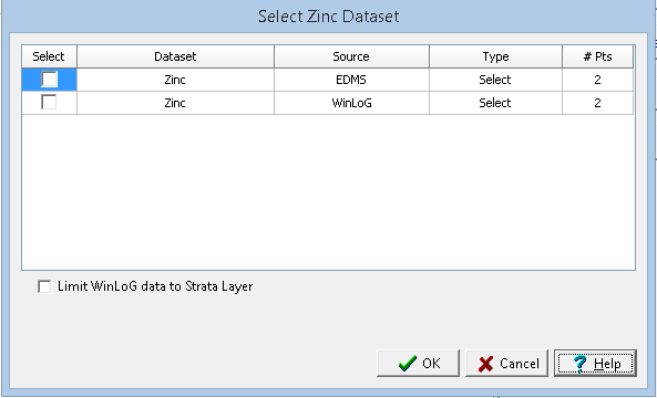
This form can be used to select the dataset to add, either EDMS, boring/well data, cross-section data or other data.The type of data is used to specify what data to use when there are multiple data points for a dataset at the same location, it can be either maximum, minimum, average, or median To select a dataset check the box next to it in the list.
The WinLoG data within the dataset can be limited to a specific stratigraphic layer by checking the Limit WinLoG data to Strata Layer box.