|
<< Click to Display Table of Contents >> Editing a Dataset |
  
|
|
<< Click to Display Table of Contents >> Editing a Dataset |
|
To edit a dataset, select it on the Data form and then click on Edit Dataset button.
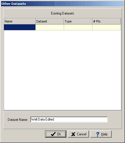
If the dataset is from boring/well data or cross-section data it can not be edited directly and a copy must be edited. In this case the Other Datasets form will be displayed. This form lists the other datasets in the database and is used to specify a unique name for the new copied dataset.
If the type of dataset is Other it can be edited directly without specifying a new name.
After this the Data form will have a new tab for Data Edit.
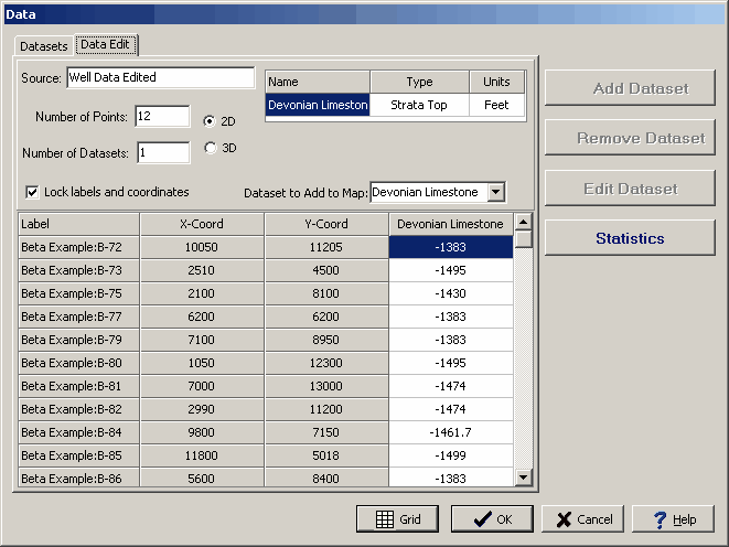
The following information can be edited on this tab:
Source: This is source for the edited dataset(s).
Number of Points: This is the number of points in the dataset(s).
Number of Datasets: This is the number of datasets. More than one dataset can be edited and added to the contour map using this tab. All of the datasets will use the same data points but have different data values.
2D or 3D: The dataset(s) can either be 2D or 3D. If the dataset is 2D the x and y coordinates can be specified. If the dataset is 3D the x,y, and z (elevation) coordinates can be specified.
Name: This is the name of the dataset. If there is more than one dataset, additional lines will be displayed for the other datasets.
Type: This is the type of the dataset. If there is more than one dataset, additional lines will be displayed for the other datasets.
Units: This is the units of the dataset. If there is more than one dataset, additional lines will be displayed for the other datasets.
Lock Labels and Coordinates: Check this box to lock the labels and coordinates so they can not be edited.
Dataset to Add to Map: This is used to select the dataset to add to the map.
Label: This is the label for the point in the dataset(s).
X-Coord: This is the x coordinate for the point in the dataset(s).
Y-Coord: This is the y coordinate for the point in the dataset(s).
Z-Coord: This is the z (elevation) coordinate for the point in the dataset(s).
Value(s): These are the values for the point in the dataset(s).