|
<< Click to Display Table of Contents >> General Data |
  
|
|
<< Click to Display Table of Contents >> General Data |
|
The General Information for a log includes information about the borehole number, drill date, well/borehole symbol, depths, elevations, and X and Y coordinates.
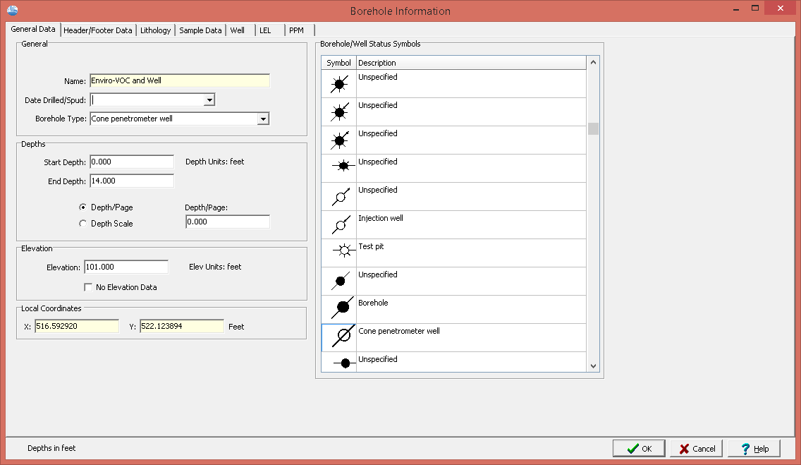
The following information can be specified on this tab:
Unique Boring/Well ID: If the module type is Oil & Gas, this is the unique ID for the boring/well.Otherwise, this is not displayed. The Unique ID can not be edited after the boring//well log has been created.
Name: This is the name of the boring/well. The name can not be edited after the boring//well log has been created.
Date Drilled/Spud: This is the date drilling started.
Well/Borehole Type: This is the type of the boring/well and is linked to the status symbols on the right of the tab. If the symbol selected is changed the well/borehole type will be changed.
Start Depth: This is the start depth. To indicate an aboveground boring/well completion a negative value can be entered.
End Depth: This is the end depth.
Depth Type: The depth per page specified in the template normally determines the plot depth per page; however, this can be overridden in the log by specifying a depth per page here. This feature allows you to change plot depths per page without changing the template. The depth per page can be overridden by either specifying a new depth/page or a new depth scale. To accept the default template plot depth per page, specify the plot depth per page as zero when editing the log.
Depth/Page: If the Depth Type is Depth/Page the new depth per page can be entered.
Depth Scale: If the Depth Type is Depth Scale the new depth scale can be entered.
Elevation: This is the elevation of the ground surface of the boring/well.
No Elevation Data: If checked only the depths at each layer boundary will be shown. Otherwise, both the depth and elevation will be shown at each layer boundary.
Local X-Coordinate: This is the x coordinate in local units. The X and Y coordinates can not be edited on this form after the boring//well log has been created. To edit the coordinates the General Information form must be used.
Local Y-Coordinate: This is the y coordinate in local units. The X and Y coordinates can not be edited on this form after the boring//well log has been created. To edit the coordinates the General Information form must be used.
If the project is georeferenced the map coordinates are not displayed on this form. To edit the map coordinates the General Information form must be used.