|
<< Click to Display Table of Contents >> Exporting GIS Data |
  
|
|
<< Click to Display Table of Contents >> Exporting GIS Data |
|
The GIS data in a project can be exported by opening a project and selecting File > Export > GIS Data. The Export GIS Data form below will be displayed.
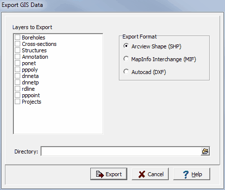
(The appearance of the form will differ slightly depending on if it is WinLoG or WinLoG RT)
The following information can be specified on the form:
Layers to Export: Check the boxes beside the layers to export from the GIS.
Export Format: The exported data can be in either Arcview Shape, MapInfo Interchange, or Autocad DXF format.
Directory: This is the directory where the exported data will be stored. To select a directory use the button on the right.
When the above information has been specified press the Export button to complete the process.