|
<< Click to Display Table of Contents >> Georeferencing to an Area |
  
|
|
<< Click to Display Table of Contents >> Georeferencing to an Area |
|
If the project is to be georeferenced to an area on the map you will then need to click on the basemap at one of the corners of the project and then while holding down the mouse button drag the cursor to the opposite corner and release the button. After this the Georeference Project form below will be displayed. The locations of the borings, wells, and cross-sections will be adjusted to within the new project area relative to the center of the project area.
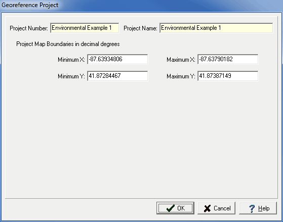
(The appearance of the form will differ slightly depending on if it is WinLoG or WinLoG RT)
The following information can be viewed on this form:
Project Number: This is the project number.
Project Name: This is the project name.
Project Map Boundaries: These are the project's boundaries on the basemap in map units.