|
<< Click to Display Table of Contents >> Georeferencing to a Point |
  
|
|
<< Click to Display Table of Contents >> Georeferencing to a Point |
|
If the project is to be georeferenced to a point on the map you will then need to click on the basemap at one of the boundary pointss of the project. After this the Georeference Project form below will be displayed.
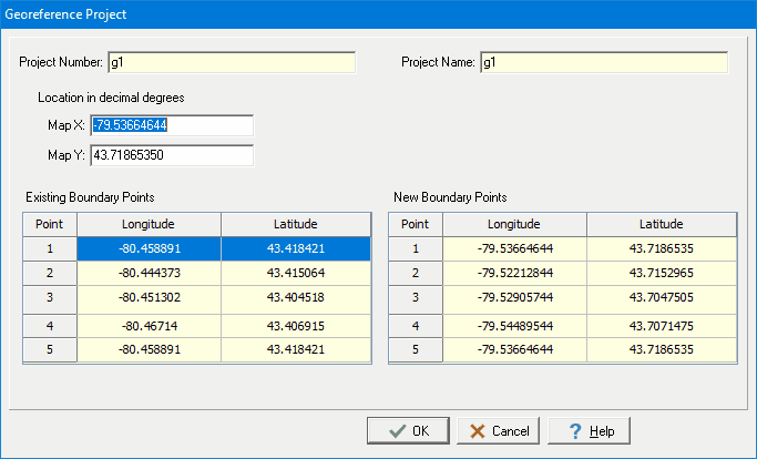
The following information can be specified on this form:
Map X: This is the X location, normally longitude, for the point on the project boundary.
Map Y: This is the Y location, normally latitude, for the point on the project boundary.
Existing Boundary Points: These are the current project boundary points. Select the line containing the point that will be assigned the new map location and the new boundary points will be adjusted.
New Boundary Points: These are the new project boundary points.