|
<< Click to Display Table of Contents >> Assigning Local Coordinates |
  
|
|
<< Click to Display Table of Contents >> Assigning Local Coordinates |
|
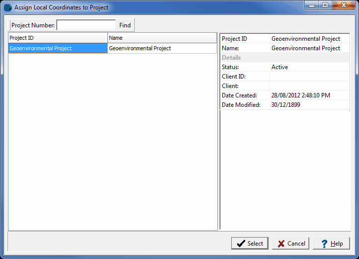
If the project is a georeferenced project the map coordinates will be in decimal degrees, for display in 3D local coordinates either feet or meters will need to be assigned. Sometimes, it may be necessary to assign these local coordinates to a project and its boreholes after the project has been created or imported. To do this select Tools > Projects > Assign Local Coordinates. The select project form below will be displayed.
(The appearance of the form will differ slightly depending on if it is WinLoG or WinLoG RT)
Use this form to select the project and then press the Select button. The Assign Local Coordinates form below will be displayed.
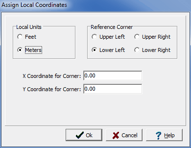
The following information can be specified on this form:
Local Units: Select either feet or meters.
Reference Corner: Select the corner of the project to use as a reference. The x and y coordinates below will be assigned to this corner.
X Coordinate to Corner: This is the x coordinate of the reference corner.
Y Coordinate to Corner: This is the y coordinate of the reference corner.
After the Ok button is pressed the local coordinates will be assigned to the project and its boreholes and wells.