|
<< Click to Display Table of Contents >> Grid Tab |
  
|
|
<< Click to Display Table of Contents >> Grid Tab |
|
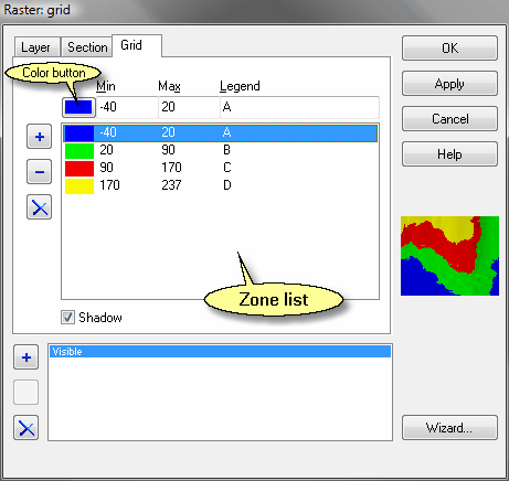
This tab is displayed is only displayed for raster layers and if the layer is recognized as a grid layer. The following information can be entered.
|
Add button: Adds a new zone to the Zone list. |
|
Delete button: Deletes the zone currently selected in the Zone list. |
|
Delete all button: Deletes all zones from the Zone list. |
|
Color button: Invokes the Color dialog box in which the user can pick a color for the zone currently selected in the Zone list. |
|
Min: Lower limit for the zone currently selected in the Zone list. |
|
Max: Upper limit for the zone currently selected in the Zone list. |
|
Legend: Name of the zone currently selected in the Zone list as it is displayed in the Legend panel. |
|
Shadow: If checked, the grid layer is treated as an height map and an imitation of shadow is cast as if the light source was placed on the left hand side of the layer. |