|
<< Click to Display Table of Contents >> Section Tab |
  
|
|
<< Click to Display Table of Contents >> Section Tab |
|
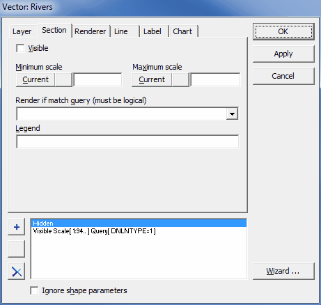
This tab is displayed for both vector and raster layers and has two sub-tabs. The following information can be entered.
|
Visible: If unchecked, the layer remains hidden, it is not rendered within the Map area. |
|
Minimum scale: Minimum scale at which the current section will be rendered; click on the Current button to fill it with the scale at the current zoom level. |
|
Maximum scale: Maximum scale at which the current section will be rendered; click on the Current button to fill it with the scale at the current zoom level. |
|
Render if match query: This is only displayed for vector layers. Query statement based on layer attributes - the current section settings will apply only to the shapes for which the logical value of this statement is true; the default logical value of the query, i.e. the logical value of the empty query, is true. |
|
Legend: This is only displayed for vector layers. Name of the current section that is displayed in the Legend panel. |