|
<< Click to Display Table of Contents >> Boring and Well Data |
  
|
|
<< Click to Display Table of Contents >> Boring and Well Data |
|
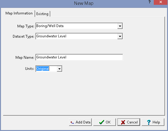
The following information can be specified for the Boring/Well Data map type:
Dataset Type: This is used to select the type of dataset to contour.
Map Name: This is used to specify a unique name for the map.
Units: If shown, this is used to select the units for the map. If Original is selected the data will be contoured using their original units.
After the above information has been specified a blank contour map can be created using the Ok button or data can be added to the map using the Add Data button.