|
<< Click to Display Table of Contents >> Environmental |
  
|
|
<< Click to Display Table of Contents >> Environmental |
|
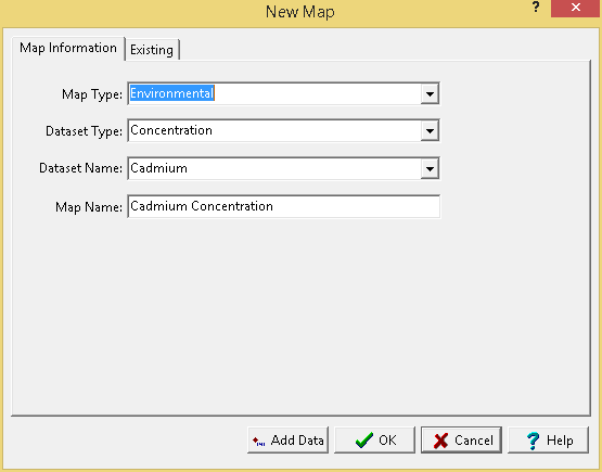
The following information can be specified for the Environmental map type:
Dataset Type: This is used to select the type of dataset. It can be either concentration or groundwater level.
Dataset Name: If the dataset type is concentration this is used to select the parameter to contour. The list of parameters that can be selected consist of those that have been analysed in the project.
Map Name: This is used to specify a unique name for the map.
After the above information has been specified a blank contour map can be created using the Ok button or data can be added to the map using the Add Data button.