|
<< Click to Display Table of Contents >> GIS |
  
|
|
<< Click to Display Table of Contents >> GIS |
|
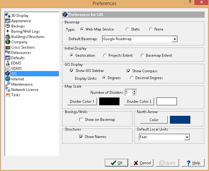
The following can be edited in the GIS category:
Basemap
Type: Select the type of basemap to use for the default. The type of basemap can be a web map service or none.
Default Basemap: This is the basemap to for a web map service or static basemap. The list of basemaps available will depend on the type of basemap.
Look up new project addresses: Check this box to look up new project addresses when a project is created.
Map Scale
Number of Dividers: This is the number of dividers in the scale bar.
Divider Color 1: Click this button to change the color of the first divider in the scale bar.
Divider Color 2: Click this button to change the color of the second divider in the scale bar.
Borings/Wells
Show on Basemap: Check this box to show the borings/wells on the basemap.
North Arrow
Color: Click this button to change the color of the North arrow on the map.
Default Local Units
Units: This is the default local units to use for projects